Driving to the End of Night

![]()
First place, “Columnist,” Los Angeles Press Club’s 2023 SoCal Journalism Awards.
Judges’ note: “A well-written ecological column is usually both informative and enticing. This piece is also a satori– for writer and reader.The author’s brilliant photos are an added plus. “
Listen to an audio version of the story, read by the author.
Whites City, New Mexico, population 85, is the greasy, last stop on this trip before the road twists and turns into that golden-hour afternoon sun and takes me to my destination: Carlsbad Caverns National Park. I’ve never been to Carlsbad Caverns before, the backyard of the great American West, unmolested by the palm trees and the other poorly conceived landscaping choices that punctuate my home of Southern California. Southeastern New Mexico sprouts pockmarked hills that climb over the rugged desert that births them — sort of like halved potatoes that have sprouted eyes. The caverns here are full of bats, calcite formations and a grand limestone chamber. It’s an outdoorsy tourist’s dream. But, I’m not here for the bats or the caves, or tourist dreams.
A few years ago back in Los Angeles, the place where the West abruptly ends in a transposed version of the Midwest, the famed photographer Josef Koudelka gave a presentation of his images at the Getty Center, one of the city’s premier palaces of gilt. At one point, after clicking on an image of the night sky, he stopped and said, “When you sleep under the sky, you realize you are nothing. You make friends with the stars.”
My own experience making friends with the stars dates to the 80s. I went to sleep-away camp in New Hampshire in the early part of the decade and worked on a South Texas ranch by late in the decade. The night comes alive in the wilderness. Trees scrape against the celestial astronomy, mountains edge it, and bodies of water reflect it back in a kind of scientific novena. Nights in both those places opened to an endless polka dotting of starlight. Under the stars of the wilderness, we are mostly removed of affectation. We can become ourselves again.
During what seems like a long ago lull in the pandemic, I pointed my car towards the west, toward the end of night.
With this in mind, I recently contacted a friend who had temporarily relocated to Southeastern New Mexico. I was curious about his place in hills above the desert, and eager to get out of Los Angeles. I was eager for the stars. When I suggested a visit and inquired about the landscape of his new home, he replied, “The thing I’m struck by most is the oil and gas in the Permian Basin. The nighttime landscape glows from thousands of lights and methane flaring. Fracking has opened up the play in a serious way.” He said that at the height of the boom — as fracking allowed access to previously unattainable reservoirs of fossil fuels — hotels in the area were charging upwards of $400 per night. “Now things have settled into a ‘new normal,’” he said. “But, the air quality and the dark, night sky are trashed.”
Traveling by car through the deserts of the American Southwest would provide me the opportunity to see what exactly an oil boom could mean to the ecologically delicate things we take for granted — like the dark of night, the stillness of the earth and the life of a desert. During what seems like a long-ago lull in the pandemic, I pointed my car west, toward the end of night.
***
The Permian Basin, a massive sedimentary basin spanning from Southeast New Mexico deep into West Texas, is the largest oil and gas field in the country. Named after the last period of the Paleozoic era, a time of mass animal extinction, the Permian is the center of a Venn diagram where fossil fuelers and deserts collide. Out here, oil and gas companies have begun to encroach on public and indigenous lands, especially in New Mexico, where the Bureau of Land Management aided private industry’s push into previously protected lands.
Despite an ongoing procession of legal challenges from conservationists, fossil fuelers flatly deny culpability while their method of extraction destroys the climate, ruins the air quality, and fires the night skies with oil flares — an absurd process that burns off excess oil and gas in sci-fi-looking towers, shooting flames the size of Volkswagen Bugs fifty yards above them. Flaring also releases poisonous clouds of smoke that then filter into the low atmosphere, sprinkling pollution wherever the wind takes them.
The heart of the Permian Basin is connected by two roadways: Interstate 10 and Highway 62. Interstate 10 spans the southern parts of the U.S. — from Florida to California, ocean to ocean. Highway 62 is less well known, but perhaps more important to this story. It cuts diagonally across the country, stretching from El Paso to Buffalo, Mexico to Canada.
While the Permian Basin provides profit for the fossil-fuel industry, Highway 62 is also home to several census-designated places and ghost towns, much like Whites City is becoming. These are outposts that meant something at some point, but are now lost. Towns that regionalism once supported wrinkle in the face of national distribution centers servicing Amazon and other international companies that freight instant gratification across the roads, interstates and highway systems of the USA.

Convoy of gratification. Photo by Henry Cherry
Along Highway 62, the most prevalent vehicles are oil and gas trucks. They’re hauling either drilling products and goods or the actual fossil fuel they’ve excavated along an often too-narrow stretch of blacktop. As such, profiles and hashtags on social media document the fiery wrecks of fossil-fuel trucks. The Permian Basin could afford a five-lane freeway. The Permian Basin could show the rest of the world how to stop shooting fiery bursts of poison in the air. But the imperative here-and-now is turning fossil fuels into money. The present threat of environmental disasters, the spreading desert that surrounds them, and the collapsing water table are still not managing to overcome the boom-times narrative dished out by the fossil fuelers and their lobbyists.
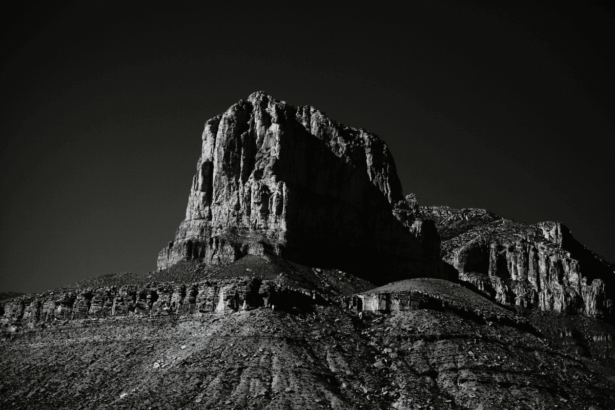
El Capitan peak in the Guadalupe Mountains. Photo by Henry Cherry
The Chihuahuan Desert — which spreads north from Mexico into the Guadalupe Mountains and east to Carlsbad — is the biggest hot desert in North America, but it’s not the biggest desert on the continent. That title belongs to the Great Basin Desert, which spreads from the Sierra Nevada Mountains into Nevada, Oregon, Idaho and Utah. It is a cold desert, like the Gobi. Cold deserts freeze in the winter. Hot ones do not.
What the diverse deserts of the world have in common is what’s underneath them. Below the aquifers that support the desert ecosystems are often found petroleum and gas reservoirs. To get at the fossil fuels, companies must drill down past the aquifer. But, the water tables are delicate; tamper with them, and the ground above will die.
The Permian Basin could show the rest of the world how to stop shooting fiery bursts of poison in the air. But the imperative here-and-now is turning fossil fuels into money.
The death of a desert differs from the death of a plant. It’s more complex, like the drying of a river or a lake, where minerals break into salty grains of sand. Without anything to lock them down, those grains travel on the wind not unlike the cause of the Dust Bowl, kickstarting a cycle of ecological death. Dust to dust.
Fracking operations are the center of an oncoming environmental nightmare. The depths drilled and the density of rock walls bored cause the surrounding earth to become destabilized, tainting nearby aquifers in the process.
Fossil fuelers regularly dump the wastewater from fracking in poorly constructed underground wells. The tainted water then seeps out. In deserts, those practices spawn dead zones.
Oil and gas companies aren’t known for any kind of careful attentiveness. Think about the Exxon Valdez disaster in Alaska, the Deepwater Horizon of the coast of Louisiana, and, most recently, the 25,000 plus gallons that leaked off the coast of Huntington Beach California last October.
It’s not just the U.S., either. In the 1960s, Russia solved the particularly complex problem of a deep underwater oil leak by shooting an underwater nuclear missile at it. In Turkmenistan, a desert crater full of methane gas has been on fire since 1971. We figured out what to do with the fuel once we capture it, but we’ve never explicitly figured out how to always capture it safely.
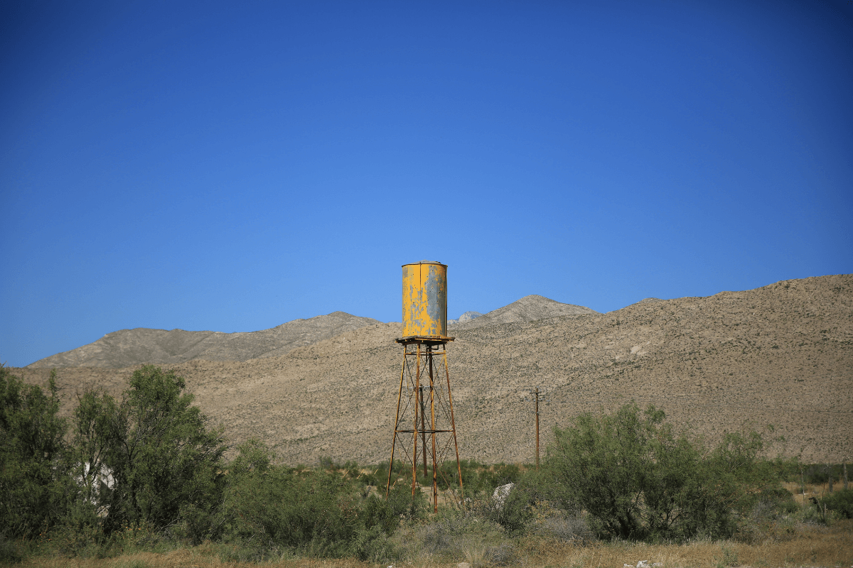
Desert water tower. Photo by Henry Cherry
Over the past 15 years, fracking has taken the dominant role in the fossil fuel industry. The ancillary damages from it have generated more dead zones. This zombie desert kinesis is a process is called desertification. In 2013, the UN dedicated a day for international awareness of desertification. Even right-leaning outlets like the American Security Project, a national security think tank, and The Wall Street Journal have weighed in on the impact of desertification in the American southwest. The EPA and NOAA have determined that “large portions of the Southwest have experienced drought conditions since weekly Drought Monitor records began in 2000. For extended periods from 2002 to 2005 and from 2012 to 2020, nearly the entire region was abnormally dry or even drier.”
Desertification is now the theme song of the American Southwest.
Some middle-of-the-road conservationists, along with European-based fossil fuel companies that have backed out of fracking, favor pipelines over the practice. Multiple lawsuits in civic, state and federal courts have set out to accomplish that. Some have even prevailed, but the fossil fuelers’ appeals to energy independence are more regularly triumphant.
***
When driving from Los Angeles to Carlsbad, New Mexico, the Mojave is the first of the three deserts I encountered. Of the three sister deserts, it’s the only one completely inside U.S. borders. The Sonoran comes next, spreading from Arizona into Mexico. Then, the Chihuahuan is the easternmost desert I traveled through; it also stokes the strongest western sensibility. The further east you travel from Los Angeles, the more western the idyll. As the megalopolis winds down, visions of the old west sprout.
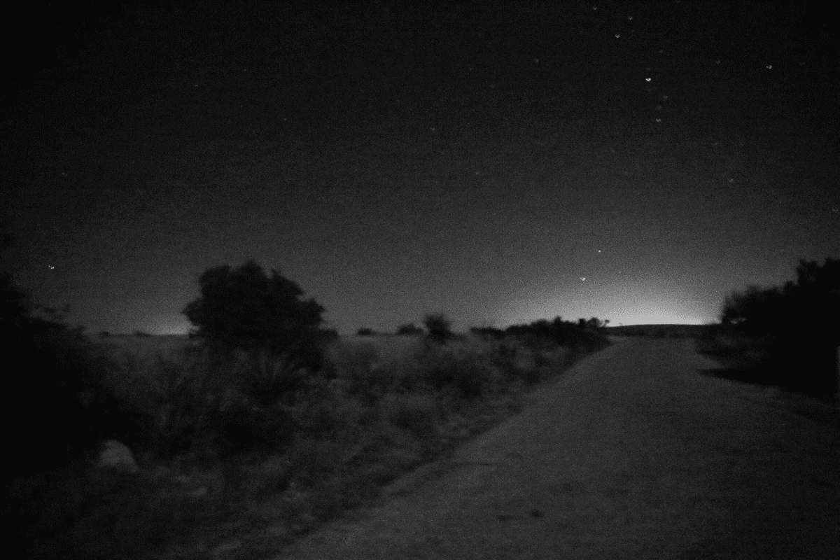
At night on the highway, there are premonitory signs of the end of night. The beaming lavender horizon carves away the darkness over cities. Our thirst for electricity, our need for this now-ism, has taken over economics and politics, draping a blanket of light over the pure dark night.
In the 70s, everyone went in search of themselves, spawned by the modulated pop philosophies and drugs of the sixties. From the ashes of the Me decade came the backlash of Reaganomics. Deregulation was the way to a better economy. Nixon did it with healthcare. Carter let the airlines have their turn. Reagan oversaw further deregulation across all kinds of industries, but he took special aim at the Environmental Protection Agency. The EPA, established during Nixon’s administration in the wake of Rachel Carson’s groundbreaking Silent Spring, had a wide mandate to protect air, water and land from man-made pollutants.
Reagan’s pick to destabilize the EPA was Anne Gorsuch, the mother of hyper-conservative Supreme Court Justice Neil Gorsuch. As the chief of the EPA, Gorsuch quickly set about downsizing the agency. She put an immediate stop to funds earmarked for a toxic superfund clean-up outside of Los Angeles. William “Bill” Ruckelshaus, the inaugural EPA chief under Nixon, took over for Gorsuch when the public groundswell against her environmental deregulation efforts threatened to undermine the conservative movement’s push toward privatization and regulatory rollback.
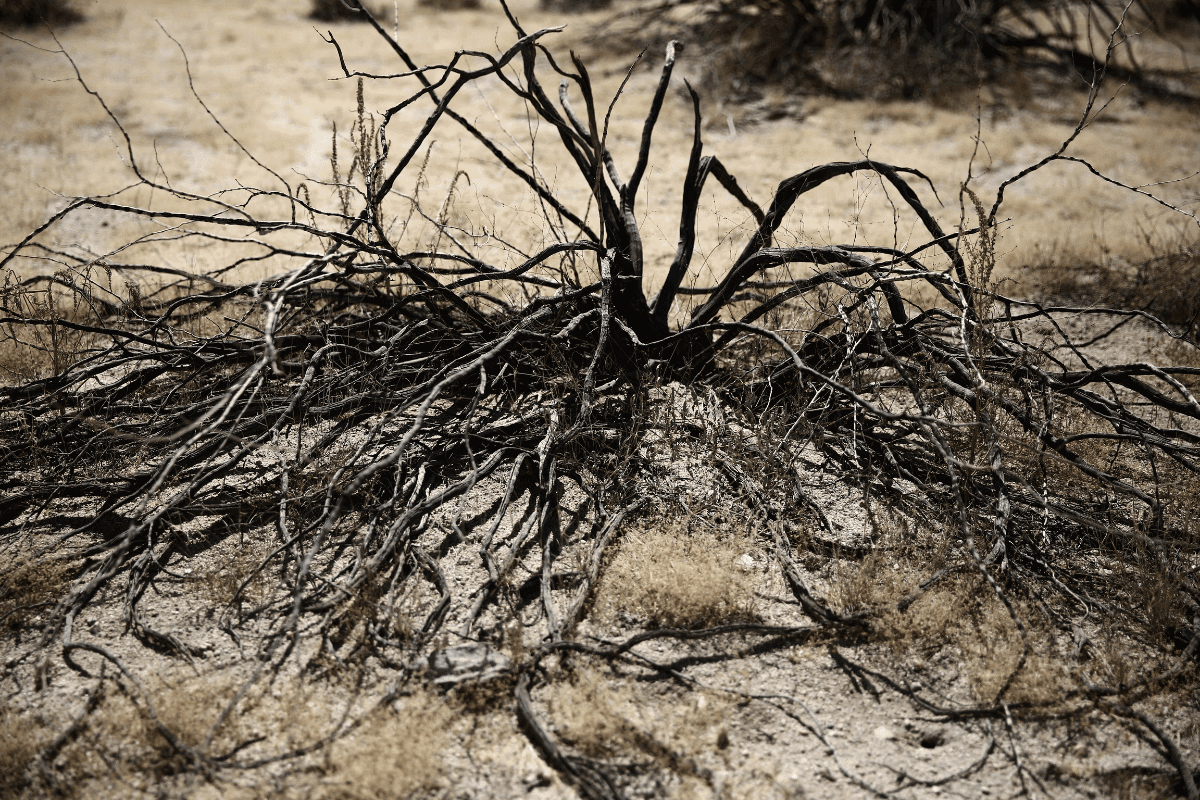
The Mojave’s desertification life cycle. Photo by Henry Cherry
When Donald Trump took office, he installed Ryan Zinke as head of the Department of Interior and Scott Pruitt as EPA chief. Both are extraction-lobby stalwarts. Pruitt is a climate-change denier and avowed opponent of an “activist” EPA. Together, Zinke and Pruitt scuttled protection against and regulation limiting drilling on public lands — many in the West.
Their handiwork came most into focus in the New Mexico portion of the Permian Basin, across from the Carlsbad Caverns, engendering a new stage of the fossil fuel boom already enveloping the region. From January 3rd, 2021 to January 4th, 2022, Carlsbad experienced 165 earthquakes. In November of 2021 alone, there were 22 quakes along the Texas-New Mexico border.
With more fossil-fuel operations came more quakes. The region experienced 422 quakes rated with a magnitude of 2.5 or more in 2021 — nearly doubling the number of quakes during 2020. And, in 2019, there were only 51. Numerous studies have been published proving that fracking scientifically destabilizes tectonic plates. Yet, in the past, larger oil and gas companies, like Exxon/Mobil, have successfully litigated against anti-fracking campaigns promoting the link between fracking to earthquakes.
In a New York Times editorial from March 7th 2017, Ruckelshaus explained the need for government regulation of environmental protections. “The federal government sets the standards and the states enforce them, with the E.P.A. stepping in only if the states default on their responsibilities…Budget cuts that hurt programs that states now have in place to meet those duties run the risk of returning us to a time when some states offered industries a free lunch, creating havens for polluters. This could leave states with strong environmental programs supported by the public at a competitive disadvantage compared to states with weak programs. In other words, it could lead to a race to the bottom.”
Desertification is that bottom.
The complexity needed to keep the Mojave, Sonoran and Chihuahuan deserts alive is desperate. The people living in the Mojave long disregarded environmental warning signs and that behavior has left the desert with a tattered inelegance. The southern stretch of the Mojave is absent of the bright, almost pastel colors that fleck the Sonora and the Chihuahuan on this trip. It is instead a million shades of beige. Housing communities and wind farms batter the natural beauty of the Mojave, leaving it leached out and ragged.
The grim setting is saved by the beautiful San Jacinto mountains and the wind farms, dressed with their enormous white propeller turbines gathering the power of air currents. The desert here is an incongruous mix of modernization, hardscrabble terrain and beatific scenery. There’s a gas stop in Cabazon, California where a guy named Claude Bell built some huge dinosaurs to attract visitors to his motel. Now, a couple of lunkhead fundamentalist Christians use them as props to teach creationism. For me, they mark the entrance to the desert. After you pass Claude Bell’s dinosaurs, the desert arrives.
***
The Saguaro National Park sits on the eastern outskirts of Tucson, Arizona, within the Rincon Mountains. The mountains that sit above these southwestern deserts get much more of the care and attention. Named for the giant Saguaro cactus that grow there, Herbert Hoover designated the area as a National Monument in 1933. Almost 30 years later, President Kennedy folded in more of the surrounding mountains and renamed it. In 1994, it was titled a unit of the National Park System.
Tucson, Arizona’s oldest city, has long had a small-town feel to it. Think Boulder rather than Boston. But in recent years, with the growth of the University of Arizona, local developers smelled a bounty. More recently, they have modeled the Baltimore-sized city on the bigger cities of the west, like San Francisco, Phoenix, and Los Angeles. Now, Tucson’s skyline feels like an aspirational reach towards cities that are two, three, and eight times its size — boomtown now-ism in full flagrancy.
Balanced against the darkest part of night in the desert outside of town, Tucson is a time bomb of light. My downtown hotel is a short walk from the old center of town. A neon sign stands alight on the roof. It sends a stream of red light down into my hotel room, drenching it with a darkroom red.
In the morning, I head east of downtown Tucson, toward Saguaro National Park, to talk about light pollution with the head of the International Dark Skies Association. Ruskin Hartley has worked in environmentalism for decades. He’s headed Heal the Bay and Save the Redwoods. A 75-pound tortoise — the family pet — joins us as Hartley explains IDA in his backyard. Officially part of Tucson, this is as outback as you can get while still tapping into the city’s electrical grid. Looking back to the city, it comes together: the further west you travel, the less classically western everything becomes. By the time you make Los Angeles, the topography links more to an East Coast idyll than anything else. It’s not western, that’s for sure.
Explaining how he got to the IDA, Hartley describes the difficult passage most environmentalist non-profits face when both fundraising and trying to connect their mission statements. “How are we going to make protection of the Redwoods relevant to people in different parts of the world? You’ll make an argument, but it’s often pretty tenuous. If you have a place where you can actually look up and see the moon, the stars…You’re literally looking to the edge of the universe. One of the things that’s nice about working on light pollution is there’s literally something everyone can do to be part of the solution, which is turn off the light when you don’t need it.”
At Grand Canyon National Park, IDA got the park to replace 5,000 lights from light polluting to dark-sky compliant, which means they are shielded and low-color. Now the park is part of the international dark sky places. Cities are embracing IDA’s lighting ideas, too. “Pittsburgh recently adopted a new light-pollution ordinance to go with outdoor light in public,” Hartley says.
Dimming of the night. Photo by Henry Cherry
When we bid farewell, Hartley points me to a trailhead in the park. It’s October, yes. But it’s also Arizona. I put on a hat and walk into the Giant Saguaros. At one point, the sound leaks out of my surroundings. After a horseback couple passes me, it’s just the Saguaros and me. As the wind picks up, it sounds like the Saguaros are growing, rustling, becoming more than they were moments ago. That’s as good of a sound as I’ll hear on this trip.
At night, looking west from the park, the rim of Tucson’s illumination hits harder than the stark outline of the Rincon mountains just northeast of the city. The hulking black range drifts into the confused haze of light pollution while the night stars struggle to outline their majesty. It’s a tough reality, this end of night.
***
Continuing east, Arizona’s Saguaros give way to New Mexico’s geological riot of orange outcroppings. I pass Lordsburg, Deming and Las Cruces. Closing in on Texas, I’m watching the passing terrain almost as close as Interstate 10. I’ve made this drive a dozen times. Scenically, as the Arizona desert improves upon Southern California’s, New Mexico’s improves upon Arizona’s.
Trouble approaches 40 or 50 miles from the New Mexico-Texas border. Traffic thins out. I’m inside a somewhat new German sedan battling with the unending convoy of Amazon trucks, painted with upturned Prime sashes that are shaped into a smile. I see the wind gather a group of dust devils across the highway. They power through the empty desert and switch back to the road. Visibility begins to decay right as signs announce the coming borderland trifecta where New Mexico, Texas and Mexico collide. Danger notwithstanding, I’m seduced by it, until the dust devils turn into a fully developed wall of sand, dust, or whatever you want to call it.
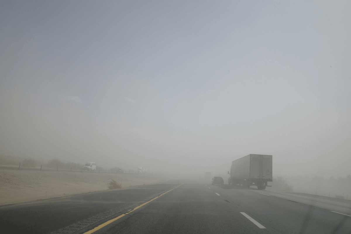
Dust storm. Photo by Henry Cherry
I’m familiar enough with the stretch of highway here. There are more road signs warning of sudden storms now than there were 20 years ago. The science behind these storms seems to stand that they are part of cycles, and the cycle we are in now is turning the southern crust of New Mexico and the western edge of Texas into a dust bowl.
When you get stuck in a sand storm, one of the first things you notice is that the air turns a sulphury yellow. Just as I’m driving into the storm, a passing tractor-trailer swings out of its lane, blown by the intense storm’s powerful winds. The sky yellows and the high-impact winds are alerts. It’s time for a pit stop.
I white-knuckle it to a highway exit on the New Mexico-Texas border. I get out of the car and start for higher ground to get a better look. A friend from college calls, and his voice calms the squirrely tension the wall of sand built inside me. This era of the pandemic has been so isolating, and the drive has compounded that same isolationist swirl. Our friendship salves the emotional quarantine of the journey I’m making. When we hang up, I hike to the ridgeline, photograph the high desert scrub brush as the sky turns back to blue. I’ll stop in El Paso. Sleep, eat and charge batteries. In the morning, I’ll head to Dell City.
Switching highways outside of El Paso, I leave Interstate 10 for the first time in days. I’ll follow the 62 through West Texas, into the Guadalupe Mountains, and then up to Carlsbad Caverns. This is the heart of the Permian Basin, and there is more industry-specific traffic. There’s more empty space, and way more grasshoppers. I’ve never seen so many grasshoppers. I see them well before I realize what they are. At first, they look like bits of a car-accident detritus. But the carnage goes on too long for that. I pull over.
The grasshoppers are almost as large as my fist. Green bugs striated with beige and yellow markings, crushed by the vehicle tide swishing east and west on Highway 62. The grasshoppers thrive in drought settings, and while there was more rain than usual at the end of the summer, the grasshoppers are readying for more drought.
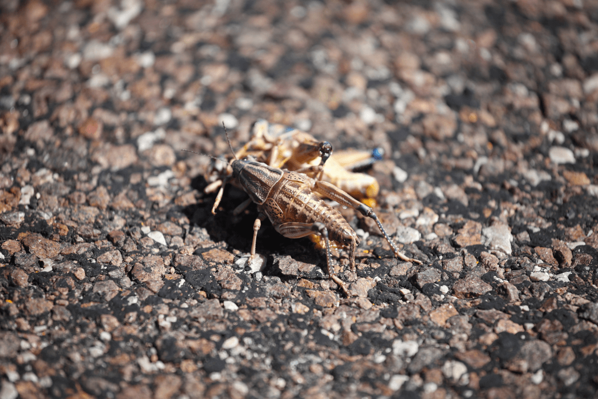
Texas-sized grasshoppers. Photo by Henry Cherry
I pull over at a ranch road. While I try and photograph one of the dying great grasshoppers of West Texas, I notice, just behind me, a withered and out-of-business mechanic shop. The lot is gravel and littered with dead grasshoppers as the live ones work their way toward the highway. A couple of car husks sit next to several rusted farm implements. It’s hard not to be depressed taking in that kind of terminal reality. While it’s not the end of the night, it’s the end of someone’s hopes and dreams on the side of a West Texas highway, laid out for everyone to see.
I look back at the highway. Roadside, as far as you can see in either direction, are grasshoppers. One half-crushed grasshopper pulls itself from the blacktop to the dirt beside it. It’s a dramatic emotional thing to witness. I wonder for a moment if I should go over and stomp it out of mercy. An oil truck passes, and I get back in the car and leave.
***
The main street is paved, but the rest of Dell City is connected by a grid of streets made from hard-packed dirt, another indication of the town’s deeper connection to the surrounding desert. When I pull over to and photograph the town’s outsized sign, I notice tissue-like bulbs of white growing beside the road. They’re growing cotton in the middle of the desert.
Farming in a desert can be dangerous to the surrounding ecosystem. Dell City isn’t any different. Right beside the lushly planted oasis are the storied salt flats. They’re marked on maps, on social media. These salt flats are a desert’s least hospitable formation. Irrigation and pesticides combine in a runoff that dilutes the desert aquifers. Poisoned by pollutants, the aquifers falter. Unable to support biotic flora and fauna on the land above, the deserts begin to also falter into a more dominant abiotic state. Keep going down this path of environmental carelessness, and eventually, that water will dry up. The sands will spread. The salt flats will take over. It’s simple. The wind takes the salt and lays it down wherever it can. The topsoil dies. The desert spreads.
Dell City. Photo by Henry Cherry
As the green wonderland of Dell City succumbs to the desert, the salt flat comes into view. The salt flat is the real reason I’ve driven this route. People are so in awe of water that when rain deluges the area, creating little blue salt lakes at the end of summer, some make the 8.5-hour drive from Dallas to plunge inside them and post their antic frolicking on Instagram. The ranchers who own the land surrounding the flats aren’t thrilled with this newfound notoriety.
Still, there’s only so much sway the Insta-fluencers have at their command. The reality is that this is drought country. Newly formed bodies of water are shocking. Fracking has polluted the aquifers and now dead zones and salt flats are growing. No amount of pop-top, beer-can partiers clinging to neon inflatable flamingo innertubes can change that. But, if you let the fossil fuelers control the narrative, the story is a hybrid of vilification and now-ism party time USA. Nancy Pelosi is bad. Instagram-friendly inner tubes on the Mikonos blue waters of the salt flat are living their best life. Drink beer. Buy gas. The science of attraction lives in the art of promotion. Amazon knows it, and the fossil fuelers know it, too.
The Salt Flat ghost town is another kind of reminder. It’s easy to skip past the economic failure it represents in favor of the geology from which it takes its name. But when the empty building on the side of the highway comes into focus, it reeks of an ending. The three-inch grasshoppers slaughtered by passing vehicles, the closed gas station, the wavering heat lines in either direction—all of these sweep across my face as equipment trucks and oil tankers speed along Highway 62.
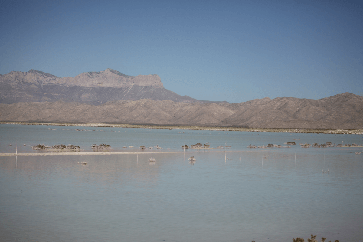
Salt flats. Photo by Henry Cherry
I taste the bits of salt deposits as they blow onto my face. Sludge from the flats coats my boots. Eventually, the sun will bake them dry. The pools will become quagmires that trap the birds and animals wandering across them. But none of that dims the pleasure I get looking into the water. It’s so mystically blue against the white of the salt. In the distance, the Guadalupe Mountains rise like stately ministers charged with overseeing this rare, absurdly beautiful vision. Even as we burn it, the gifts of nature appear.
Rocky and majestic, the Guadalupe range climbs with me as I pull out of Texas and return to New Mexico. The desert reaches up to them, and the fine bits of sand turn into rocks, which later turn to boulders, and then the dramatic outcroppings that form the 8,000 + foot peak of El Capitan, several hundred feet higher than Yosemite’s same-named peak.
The grandeur that makes this state so gorgeous to hike around should also be an alert. New Mexico is in a battle over its public lands. The battle stretches up into the night sky and plunges into deep underground wells. The previous administration opened those lands to private industry, largely dominated by oil and gas companies looking to drill in the previously inaccessible parks and preserves. As the process of fracking has become de rigueur, New Mexico has experienced a fossil-fuel bonanza — the boom my friend messaged me about. With its public land opened to drilling, New Mexico’s Governor, Democrat Michelle Lujan Grisham, carved out a deal that let fossil fuelers continue fracking while making 30 percent of the state’s public land off-limits by 2030. Republicans condemned the legislation for boxing the industry out. Conservationists faulted it for letting them in.
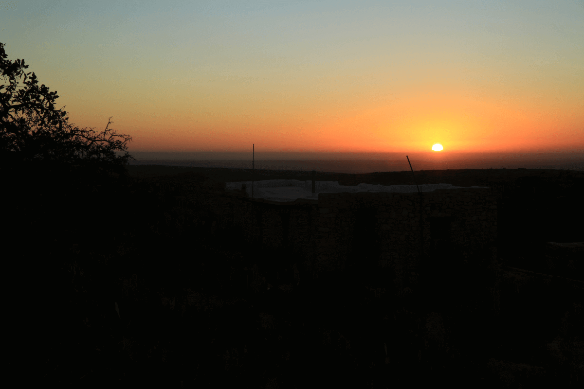
Sunrise over Carlsbad Caverns. Photo by Henry Cherry
The city of Carlsbad contains those paradoxes. It is a quizzical town with an all-eggs-in-one-basket economy and the social conservatism of Republican-led states in the American South. The median income has risen well above state levels, more than doubling since 2000. Unemployment is dropping fast.
Still, amidst all the boom-town wealth, the city has an absurdly high teen-pregnancy rate and has installed a nursery at the local high school. The public lands of Carlsbad Caverns are a 25-minute drive south of the city. People living paycheck to paycheck don’t usually have the economy of time to habitually haunt the national park. But, as members of the poverty class, fossil fuelers provide benefits derived from the fossil fuel industry — jobs mostly, but also privately funded, publicly assessed resources (such as libraries) — to the communities they want to drill in. This makes it nearly impossible, or at least not pragmatic, to argue against the allocations and allotments of oil and gas. By comparison, the National Park has fewer tangible gifts.
***
The caverns are high on a ridge in the foothills of the Guadalupes, southwest of town. Once darkness starts to come, I stand on a ridge looking out over what I guess out loud to be the city of Carlsbad. “No,” my host, who asked not to be named, tells me, “that’s not Carlsbad. That’s the man camps.” Man camps are just what they sound like — temporary encampments of men hired to excavate fuel from underground reservoirs.
I look again. The lights run wide across the east on the other side of 62. North of them I spot the larger dome of lights emanating from Carlsbad. Those lights, electric and cleaner, are steady. The lights I first mistook for the city are the glare of the fossil fuelers and their oil flaring. They bobble on the horizon, casting an eerie pall of lavender light. The lights remind me of the camping warriors in Lawrence of Arabia. My friend nods. To him, they’re the Orc camps in The Lord of the Rings. We’re both right. Those wavering flames are the work of raiders, carelessly disintegrating the darkness.
When that nocturne is gone, how else will we define ourselves? Looking down the valley from Carlsbad Caverns, the end of night is tangible, like salt dissolving on your tongue.
Help us sustain independent journalism...
Our team is working hard every day to bring you compelling, carefully-crafted pieces that shed light on the pressing issues of our time. We rely on caring supporters like you to help us sustain our mission. Your support ensures that we can continue to provide deeply-reported, independent, ad-free journalism without fear, favor or pandering. Support us today and make a lasting investment in the future.
RELATED STORIES


Award Winning


Today’s environmental and social justice challenges are unprecedented, and require an unprecedented collective effort.


Stay updated on our latest features, events and more. Subscribe to our Note From the Nest newsletter!
I am mesmerized by your storytelling and just couldn’t stop myself from reading and listening to you. Hope to write such a heavenly column and share it with you. Waiting for more amazing blogs from you.