Rising Seas, Unease & Coastal Erosion
Living on Capistrano Beach in Dana Point was a dream for Michael Draves, where he would get to hear the sounds of waves crashing onto the shore, and feel the nice ocean breeze and crisp, salty air. All of these things are what make living on the California coast a fantasy for many, but the actual reality of living along the Golden State coast can also be alarming.
“I’m worried about a big storm coming and flooding our house completely. That happened to several of my neighbors on the road, and they suffered a lot of water damage,” says Draves. “Every day the ocean is doing more and more erosion to the beach, which is decreasing the amount of sand we have. This not only gives us less space to be able to enjoy the beach but also lessens the amount of beach available for people to walk along, which includes for residential and non-residential use.”
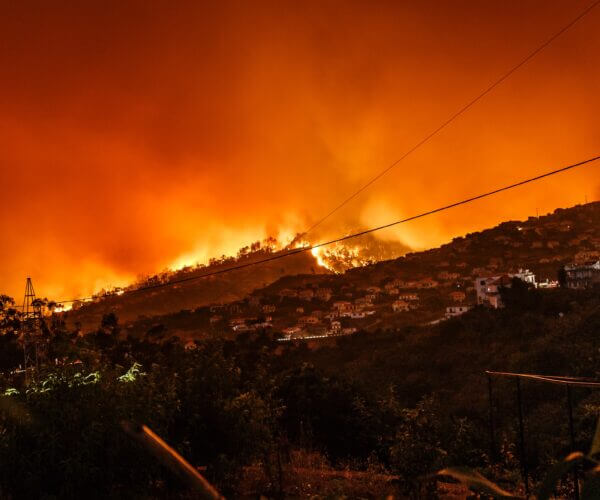
The eroding coast has been a problem in California for decades, one that is arguably not getting enough attention from the media or in policy discussions at a state or national level. Climate news in California is dominated by droughts, wildfires and mudslides, but rising sea levels pose just as grave a threat to the state. Sea levels impacting the California coast have been rising at the rate of 0.1 inches (3.3 millimeters) per year over the past 30 years due to thermal expansion — warm ocean water mixing with increased melt-off from ice sheets and glaciers.
… scientists are anticipating that one- to two-thirds of beaches “will suffer extreme erosion” to the point where they will fully disappear by 2100.
Geologists call this the vertical land motion, or subsidence and uplift, which are the main causes of California beaches getting smaller and smaller, with sea levels off the coast rising about 6 inches since 1950. In San Francisco, rising sea levels in the past decade have increased to 1 inch every 10 years.
A 2-foot rise in sea levels is expected by 2050. According to the website California Beaches, scientists are anticipating that one- to two-thirds of beaches “will suffer extreme erosion” to the point where they will fully disappear by 2100.
Even the largest beaches in California aren’t safe from the rising sea levels, believes California Beaches, because every year they will shrink more and more with higher tides and less dry sand. This would make beaches less accessible, particularly where homeownership and public access to beaches — a right of all Californians up and down the coast — come into conflict.
Beaches in areas that have been most affected so far and that are most vulnerable to rising seas and erosion include San Diego, San Clemente, Dana Point, San Pedro, Palos Verde, Malibu, Ventura, Santa Barbra, Big Sur, Santa Cruz and numerous Northern California coastal stretches. If we don’t take action, the beaches we know and love could be gone at a blink of an eye.
Cliffs and bluffs also are vulnerable to the rise in sea levels. The United States Geological Survey looked at Southern California’s deteriorating cliffs across 300 miles of coastline and found that “19 to 41 meters of the coast will have retreated” by the end of the century. Coasts surveyed, such as the San Diego coastline, will experience swift retreat because of their lithology, according to the study. A lot is at stake here — from the loss of wildlife habitats and homes — and it’s not some far-off-in-the-future problem.
Michael Draves loves living on Capistrano Beach, his home for more than a year now. But his bliss is undermined by the fear that his home could be swept away. During Fourth of July last year, the Draves family spent most of the day protecting its home from the storm that flooded nearby Newport Beach during this time. The high tides and big swell that hit Capistrano Beach tore up walkways and reached beach parking lots, rendering the beach closed.
A lot is at stake here — from the loss of wildlife habitats and homes — and it’s not some far-off-in-the-future problem.
In December 2018, a massive storm hit the same beach, crumbling the sea wall and pedestrian walkway. The erosion was bad enough to reveal car parks that had long been buried under cement. In the aftermath, the county put up temporary boulders and moved around some sand to protect homes, but little of significance has been done to address the underlying issues here or elsewhere.
Proposed plans, such as a large beach replenishment effort, are stopgap measures; large storms continue to decimate the coast. Another proposed course of action is the creation of a hybrid dune protection system, which “would consist of adding hard protection — including stone, cobble and geotextile fabric — under a rehabilitated vegetated dune.” This could possibly help prevent further erosion on the coast.
The final option is to move communities farther away from the coast, allowing for beaches to widen and to create a buffer to absorb wave energy. This is a more permanent solution but, understandably, it’s not one most of those who are living the dream want to contemplate.
“It is not preferable to retreat because we want to stay where we are. We love our home and where we live. We don’t want to give that up,” says Draves. “It eliminates jobs of security and grounds keeping and everything else that goes into maintaining the community.” ⏤ Angélica Escobar
Coastal Erosion
Images of California’s changing coastline, by Shannon Aguiar
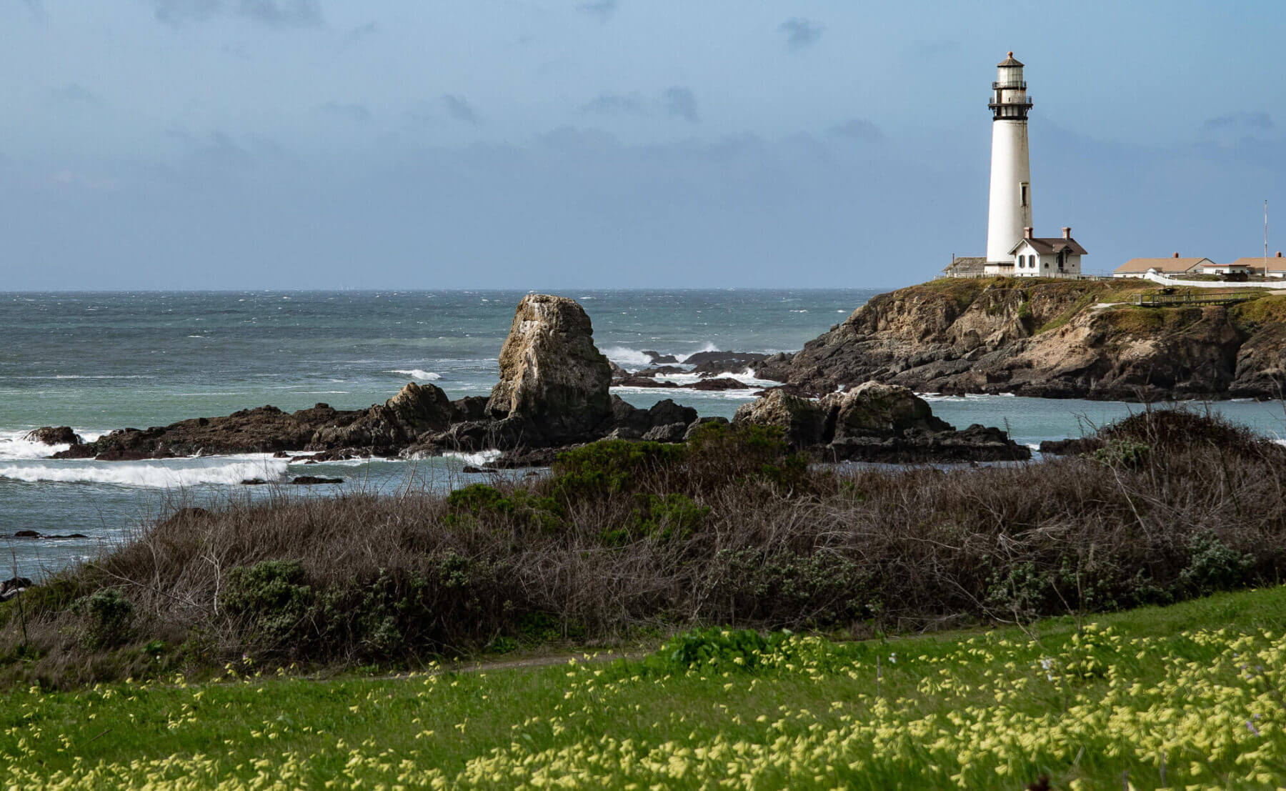
Pigeon Point Lighthouse
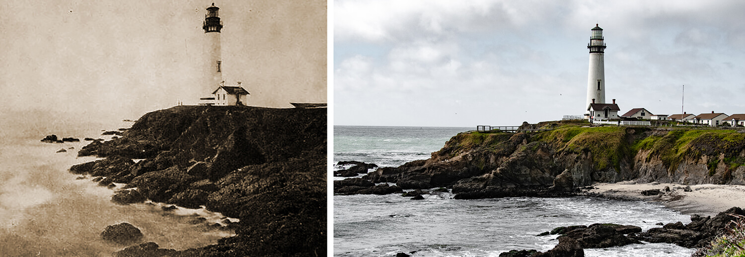
(left) Photo by Colin Walters, 1923. (right) Photo by Shannon Aguiar, 2021.
210 Pigeon Point Rd., Pescadero, CA 94060
No longer operational, the Pigeon Point Lighthouse, built in 1871, still stands tall as if it had once been permanently painted into the coastal scenery of Pescadero. Having faced gusting winds and crashing waves, the cliffside historical site resides in the lower half of Northern California. Now a hostel with new structures added over the years, the mystical location is popular among young adults. While some of the nearby trails have been blocked to preserve the land, a number of young visitors recently could be seen ignoring the barriers and fencing while taking a hike.
Bixby Creek Coast From the North
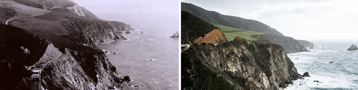
(left) Photo taken in 1932 (WikiCommons). (right) Photo by Shannon Aguiar, 2021.
Bixby Creek Bridge, CA State Route 1, Monterey, CA 93940
Although it bears a similar appearance to when the nearby bridge was constructed in 1932, there are noticeable changes in the hillside: habitual reconstructive efforts have carved the winding road much deeper into the hillside than before.
Bixby Bridge Structure From the North
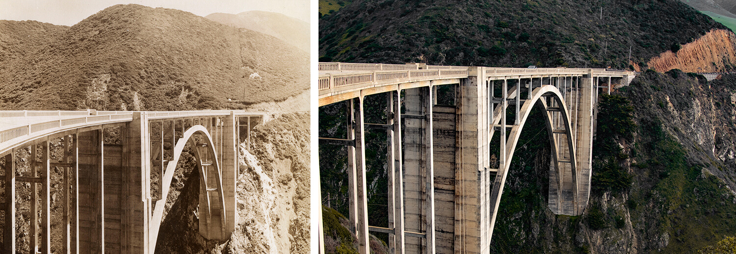
(left) Photo by Chronicle, 1935 (right). Photo by Shannon Aguiar, 2021.
Bixby Creek Bridge, CA State Route 1, Monterey, CA 93940
Named after businessman Charles Henry Bixby, a pioneer of the West, this is one of the most photographed bridges in California. Savvy travelers know this vista also offers the last chance to use a restroom for the next 18 miles. Visitors who would like to view the structure, though, can expect to have to maneuver around inconsiderately parked cars, obnoxious social media influencers taking selfies and travelers who have chosen to relieve themselves off the side of the cliff. Locals have taken to posting humorous signs warning tourists not to abuse the historic location as a toilet, including one that says, “Sasqwatch Eats Pooping Tourists.”
Sutro Baths and Cliff House
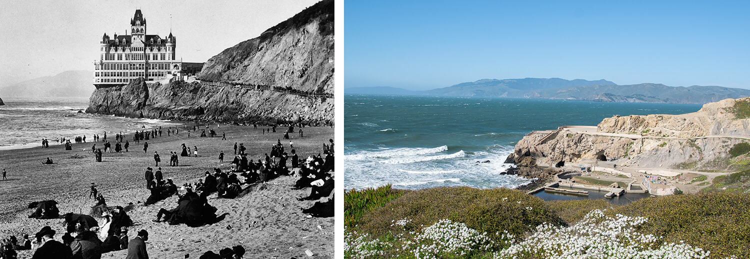
(left) Photo credit Niday Picture Library, 1902. (right) Photo by Shannon Aguiar, 2021.
1004 Point Lobos Ave., San Francisco, CA 94121
Formerly a vision of pre-Covid-style community gatherings, the Sutro Baths at Lands End are an ever- evolving collection of ruins from an era of analog entertainment. Self-made millionaire Adolph Sutro built the Sutro Baths and Cliff House in 1894. Once a saltwater pools open to the public, what is left of the site following the 1966 fire until present day now resembles a concrete graffiti-covered labyrinth outlining the former structure. Walking along the ruin’s edge, one can expect to become overwhelmed with the salty air, crashing waves and seaspray. At this location, expect to encounter a mix of artists, tourists, locals and squatters looking for the perfect spot to collect California vibes.
Point Sur
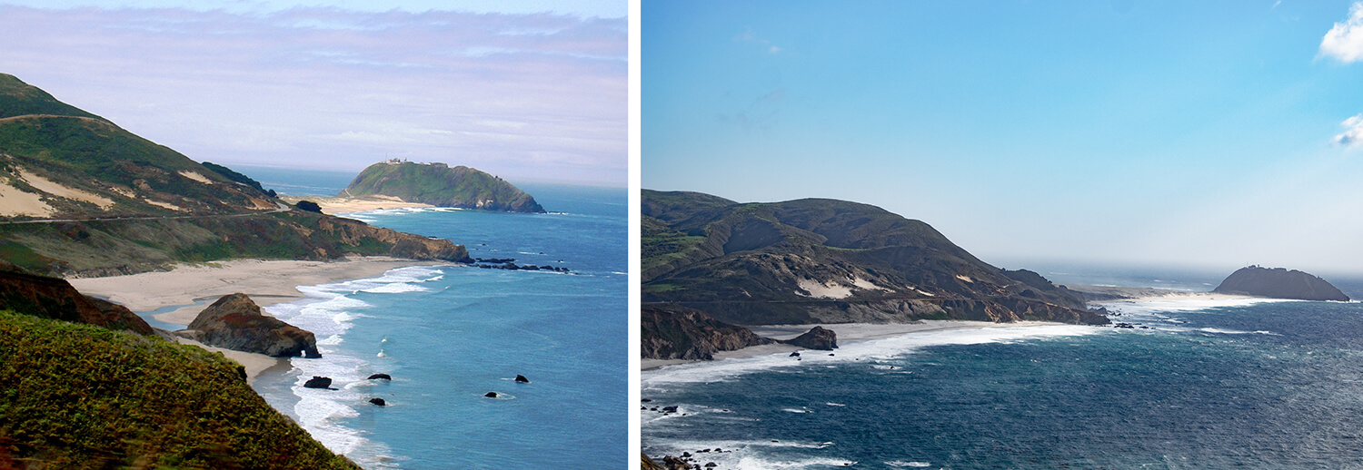
(left) Photo taken in 2005 by Hest6960 (WikiCommons). (right) Photo by Shannon Aguiar, 2021.
Cabrillo Highway, Monterey, CA 93940
Traveling south past Bixby Creek, travelers will likely spot a fog-encased hillside, known as Point Sur, from a distance. With an empty winding road leading up to a shadowed hillside and lighthouse, it is easy to become distracted by the scene of hundreds of cows grazing from the roadside fence all the way back to the ocean.
McWay Falls

(left) Photo by Dennis Frates, 2016. (right) Photo by Shannon Aguiar, 2021.
52801 CA State Route 1, Big Sur, CA 93920
Only accessible after taking a short hike and crossing through a tubular man-made tunnel in a cliffside, McWay Falls harbors an 80-foot-tall waterfall tucked into a private cove. At first glance, this sandy cove at Julia Pfeiffer State Park looks as though it has never been touched by man; however, its intentional appearance is a product of regular maintenance and careful planning. This spot has a long history of mudslides, and in 1983, the falls underwent a series of reconstructive efforts. Now, the falls no longer fall directly into the ocean. Visible in the photos above, as result of the debris having moved south, a sandy beach formed under the falls that wasn’t there before the reconstruction.
-
(left) “Pigeon Point Lighthouse” by Colin Walters, 1923. (right) “Pigeon Point Lighthouse” by Shannon Aguiar, 2021.
-
(left) “Bixby Canyon Bridge under construction on California Coast Highway 1” taken in 1932 (WikiCommons). (right) “Bixby Canyon Coast” by Shannon Aguiar, 2021.
-
(left) “Bixby Creek Bridge” by Chronicle, 1935. (right) “Bixby Creek Bridge” by Shannon Aguiar, 2021.
-
(left) “Sutro Baths and Cliff House” photo credit Niday Picture Library, 1902. (right) “Sutro Baths” by Shannon Aguiar, 2021.
-
(left) “Point Sur” taken in 2005 by Hest6960 (WikiCommons). (right) “Point Sur” by Shannon Aguiar, 2021.
-
(left) “McWay Falls” by Dennis Frates, 2016 (right) “McWay Falls” by Shannon Aguiar, 2021.


Help us sustain independent journalism...
Our team is working hard every day to bring you compelling, carefully-crafted pieces that shed light on the pressing issues of our time. We rely on caring supporters like you to help us sustain our mission. Your support ensures that we can continue to provide deeply-reported, independent, ad-free journalism without fear, favor or pandering. Support us today and make a lasting investment in the future.
RELATED STORIES


Award Winning


Today’s environmental and social justice challenges are unprecedented, and require an unprecedented collective effort.


Stay updated on our latest features, events and more. Subscribe to our Note From the Nest newsletter!